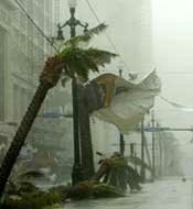
Hurricane Katrina roared across the New Orleans region Monday morning August 29, 2005. My wife and I and our two teenage sons evacuated August 28th and just my wife and I returned to our un-flooded home September 19th. In those three weeks of evacuation we traveled back and forth within seven states (LA, MS, AL, GA, SC, AR, KS), left one son in MS to start college and one son in KS to finish high school. We stayed with family, friends and in five different hotels and put 10,000 miles on our two vehicles. Hurricane Katrina is history now and New Orleans has definitely moved on! But for those of you who are interested, below you will find some pictures I took of the New Orleans area when I returned home in the aftermath of Hurricane Katrina.

Information about Hurricane Katrina
1. Hurricane Katrina was the sixth strongest hurricane ever recorded and the third strongest hurricane ever recorded to make landfall in the U.S.
2. Hurricane Katrina was forecast as a Category 4 featuring gusts topping 140 miles an hour.
3. Hurricane Katrina produced a maximum storm surge of more than 25 ft.
4. Hurricane Katrina displaced one million Gulf Coast residents.
5. The final death toll was at 1,836, primarily from Louisiana (1,577) and Mississippi (238).
6. About 80% of New Orleans was under water, between 2 feet and as much as 20 feet deep in places.

The Winds of Hurricane Katrina
This picture of the snapped pine trees should give you an idea of hurricane Katrina�s winds. On Sept 19th my wife and I were heading home from SC to New Orleans. This picture was taken on Interstate 59 just south of Laurel Mississippi. Laurel is about 100 miles north of the Gulf Coast.

Returning to a Deserted New Orleans after Katrina
Coming home to an empty city in the wake of hurricane Katrina was an eerie feeling. Many parts of the New Orleans were still flooded but the areas that weren�t flooded were deserted and mostly non functional. Many people took weeks, months, and years to return home. This picture was taken from my truck while crossing the Crescent City Connection. This bridge normally carries approximately 180,000 cars per day.

Katrina's Wind damage to a Westbank neighborhood
My street after Katrina, I was very fortunate because I lived on the Westbank which had very little flooding. However, you can see where the wind has shredded the mighty oaks that line my street. Damage in my neighborhood included wind damaged roofs, trees falling on houses and water damage from rain pouring in through damaged roofs.

 One very noticeable thing when you returned home to New Orleans after hurricane Katrina was the number of abandoned boats throughout the city. These were the boats, most of them commandeered that had been used for rescue purposes. When the flood waters receded the boats were just left behind. Many boat owners never recovered their missing boats.

The results of Katrina's tidal surge
When the flood waters from hurricane Katrina were finally pumped out of the New Orleans area this shrimp boat was left stranded in a Chalmette neighborhood. By looking at the marsh grass and debris on the roof of the house it gives you an idea how high the flood waters were in this neighborhood.


 Trolley Route
 Red Bus Route
